
Unfinished Business
30 March 2016: Trek4PTSD Zero Day 2; Camp Pendleton, Ca.
The day started with a sense the feeling that I had some unfinished business. The morning prior I had left Mount Laguna with the feeling of defeat. The decision to leave the mountain the day prior was the right one, but it did not help. As I typed away, recounting the previous days I wanted to go back, I needed to go back. The time was there and I could go back and finish this leg, I would not be defeated.
Later that day the decision was made. I asked my wife if she could take me back the next morning and drop me off where I had stopped. Without hesitation she said yes. Now it was a mad scramble to put the lessons learned in the previous three days into action and adjust my pack. In an attempt to save a few precious ounces, about four, I checked REI’s website to see if they had received the Therm-A-Rest Z-Lite mat, they did. We rushed there and purchased the new mat. A stop at the grocery store to buy a couple of bottles of Smart Water to replace the heavy Nalgene bottle, again a savings of probably two ounces which were replaced by the additional half liter I was carrying.
With all purchases made it was time to repack and get some rest. The next day would have me back on the trail.
31 March 2016: Trek4PTSD T-0:30; Sunrise Trailhead Parking Area
Having prepared for the journey ahead, I had consumed large quantities of water and Gatorade. With just 30 minutes before the journey would continue, the amount of liquid I had taken in had to start coming out. We pulled over into the trailhead so that I may use the bathroom. There, as we pulled in, we noticed another PCTer. He looked familiar and I asked, “Is that Brad?” Much to my surprise it was. I was very excited to see him and a sense of sadness came over me. I knew his end goal was Warner Springs and at best that was two and a half days away. His goal was to make it there by April 1st where his wife would pick him up. He would not be able to finish and would only make it as far as Scissors Crossing, 32 miles short of his goal. The storm that forced me off the mountain had put a major roadblock in his plans. The silver lining was that he would be able to continue down the mountain and do the best he could. As if the storm had not been enough of a stumbling block, one of the major support poles for his tent had broken and he was not set up to go Cowboy Camping, the previous night he had slept in the outhouse away from the elements.
But the time to catch up had to be caught short. He had wondered where I was and seemed glad to see me again. I could not pass up this opportunity to see this trail friend of mine once again without capturing the moment. With phone in hand I snapped a picture of the two of us so that I may remember this fellow PCTer.

Brad & Raul
Trek On Brad. I am certain you will be back and will continue on your journey. Now it is time for me to continue on mine.
31 March 2016: Trek4PTSD Day 4; Mile 47.5; Mount Laguna Campground
The time come as we arrived at the exact same spot that I had left the trail. A scenic overview platform that gave a magnificent view of the desert floor below. The temperature was in the low 30’s and I had just a t-shirt and light pullover on. Better to start off cold and warm up, than to start warm and sweat. That could lead to being colder than I would of been without it. I strapped on my pack and had to pose for a picture with the desert behind me. As I stepped off I would encounter two PCTers who spent the night just below the platform. They did not know that the campsite was just less than a half mile up the road. After talking to them for a few minutes, I was on my way. Leaving, I said the required phrase, “see you when you pass me up” believing that it would be so. I did not see them again.
As I made my way down the trail I was glad I made the decision to not continue on Tuesday. With the storm gone, the views were breath taking. I gazed at the desert below and the cool wind made the trek that much more easy. Time seem to go by slow, but the miles were flying by. In just a little over two hours I had made it to Pioneer Mail Trail Picnic Area, named for the pioneers of the mail service who made their way over the mountains to bring the mail out west. Upon my arrival to take a short break, I saw two hikers in the park. One of them was getting in a mini van and the other was getting ready to get back on the trail. The one getting in the car was the girl I had met on day one less than a mile into the journey. She is the one that walked four miles in the wrong direction. I did not have the opportunity to talk to her, but I finally learned her name, Rainbow. She was headed back to Mount Laguna to return the sleeping bag she had exchanged at the outfitter store there. Come to find out that she had not slept for two days and when they looked at her sleeping bag up against the light, they could see patches where light was shining through. Also, later I found out that her budget for the entire thru hike is very small. Her luck in the first 53 miles has been disastrous and I fear for her on the trail. I hope that she finds better luck on her journey.

Here is also where I met Sheppard. He earned his name on day one when he ran across another PCTer who didn’t look too hot. After about half a mile after passing his fellow hiker, he decided to wait for him and make sure he was alright. The hiker he waited for had only brought two liters of water for the first 20 miles, a substantial low amount of water for such a long stretch without a reliable water point. Sheppard gave the hiker some of his water and stayed with him, or “shepparded” him until he could get more water. Sheppard is from the outside of Richmond, Va. and seemed to be in his late teens or early 20’s. I would see him again at camp that night.
As I continued on the trail I would run into one of the funniest and most entertaining characters so far. I had met Rebo at Lake Morena on day two just a few minutes prior to leaving. He is from Pasadena, Ca. and probably in his late 50’s or early 60’s. I deduce this based on his stories, but I cannot be certain. As far as his name, that is unclear as well. He explained that he got it from a folded piece of cardboard that they saw along the way. His stories made for great dinner time entertainment and he had met plenty of people in his prior hikes. It also appeared that he was taking video or pictures at every turn and is working on a YouTube channel that he hopes to call something along the lines of PCT Water Report. Having already done a thru hike of the PCT, he was only doing a fraction of the entire trail with the Class of 2016 and is planning to hike the CDT in 2018. I look forward to his channel and hope to run into him some day.

Rebo & Raul
As I passed mile 54 I was startled by someone saying “behind you”. Without making a noticeable sound, or just through sheer speed, a group of six cross country runners passed me by. Shortly after that four girls from the same high school team passed me and then their coach. I was impressed by how well they were handling the altitude and environment. They would run past me again going the other way. My understanding is that they were a team from Massachusetts. A mile or so later they would pass me again going the other way.
I would pass Rebo once more before arriving at mile 59.5. This is where I would detour off the trail to get some water. I arrived at the Sunrise Trail head about a third of a mile off the PCT. This is where I saw Brad earlier that day. I walked up to the tank and filled my Gatorade bottle with water. Spent a few minutes relaxing with my pack off before making my way back onto the trail. Where the Sunrise Trail and the PCT meet, I ran into Rebo once again as he was taking some video for his YouTube channel. Once more I was on the PCT.
As I continued on the trail Rebo, the seasoned hiker, would pass me up once again. There were about four miles to what I thought would be the campsite for the night. That would of made it a 14 mile day. However, Rebo would convince me to keep going to his destination for the night. As I passed mile 63.7 I saw what was originally going to be my campsite. It was a beautiful little spot that would of provided a wonderful home for the night. I had given my word that I would continue and as I made my way uphill on the Jeep road. Just a few minutes into the uphill trek I began to question my decision. But there is no going back on the trail, so I pushed forward.
At around 1830 that evening, I made it into camp where Rebo was just finishing up with his tent. He looked at me and said, “told you, you would be here by 6:30”. I found an area hidden by one side by bushes providing some cover in the event of some winds. I was glad I made it to this little spot, it provided great views and most important, water. Since I had filled up with water at every opportunity and in no real need of water at camp that night. Once I set up my tent it was time for some dinner. I pulled out the bottle of Gatorade that I filled with water that needed to be filtered. Finally, here is where the water filter comes into play. The water was clear to begin with, but there was a warning to filter it, so I did. When the water made its way through the filter it came out gray and foamy. I knew this was due to using the filter for the first time and the grey color was carbon and that won’t hurt me. That night I would eat good, have great conversation and most important it was a quiet night. The only downfall, besides getting up to go to the bathroom, was that in the 45 degree night I would wake up sweating. Simply taking out the silk liner and changing my shirt would be enough to make the night comfortable again. It was the first real good night of rest I would have on the trail after an almost 21 mile day.
1 April 2016: Trek4PTSD Day 5; Mile 68.4; Rodriguez Spur Fire Tank Campsite
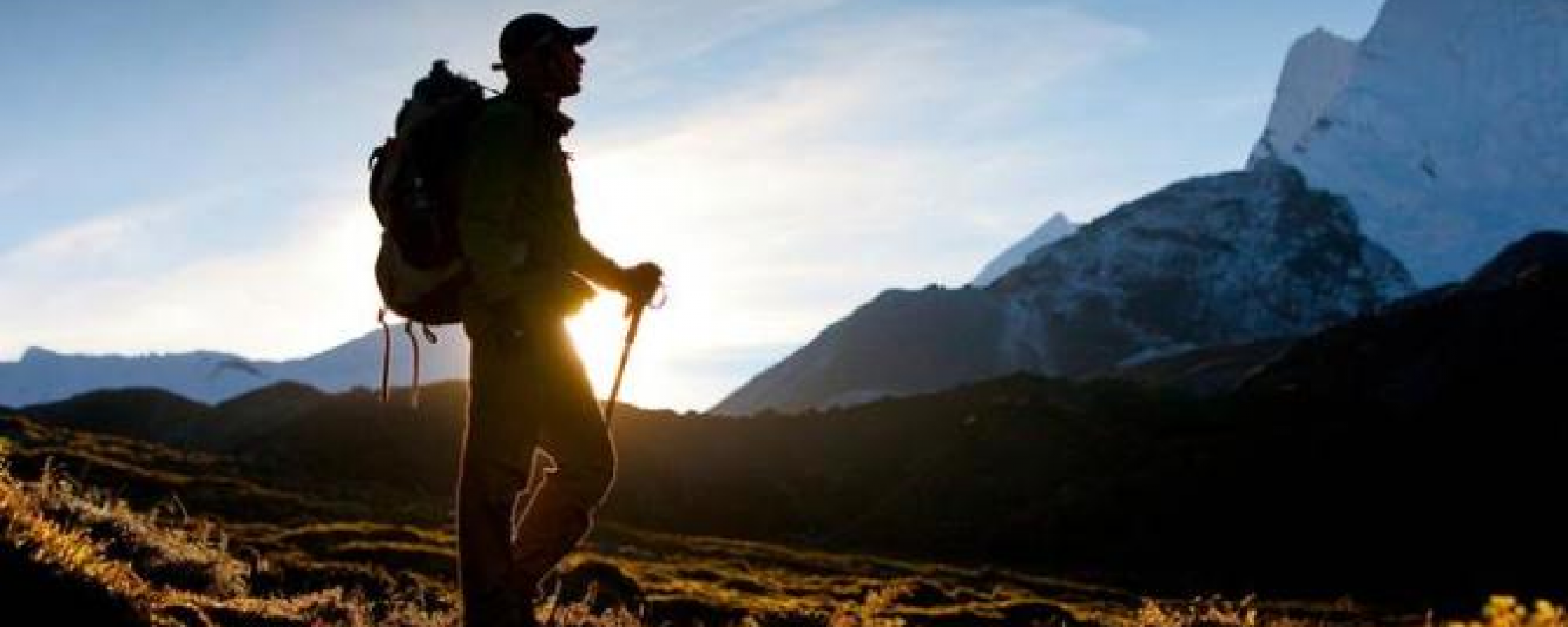
After a good night of sleep it was time to wake up and get the day started. Before exiting the tent, I changed into my hiking clothes and packed what was in the tent. It was just before sunrise when I exited my tent and everything was great. I started to get my breakfast ready, just some oatmeal and coffee. As I waited for breakfast to be ready it was time to break camp. The sunrise was beautiful and the moment had to be captured. This was the first time that I had been able to witness the sunrise and one of the things I had looked forward to since planning began. This sunrise is nothing compared to those that I am sure to come, and am looking forward to them. The picture did not make it justice, but it is a start.

As I enjoyed my breakfast and studied my map for the day ahead one of the hikers, Hardway, made his way back on the trail. I was the second to leave camp. This would be the last time I would talk to Rebo, Sheppard and the other PCTers that spent the night there. It was time to get back on the trail and make my way down the mountain.
On my way down I would run into Hardway again. I had met him on day two at Lake Morena. His story is still a mystery to me, but I did enjoy his company even if for just a few minutes. On the way down we would meet two day hikers who were heading up the mountain. They would be the first of many day hikers I would meet over the next couple of days. As I made it to level ground I ran into Major Tom who had been following Hardway’s progress through Rebo’s Facebook page. They had hiked together the previous year and it seemed like two brothers who had not seen each other in years meeting up again. Hardway was having problem with his feet, so he rested with his old friend while I carried on.
As I approached Scissors Crossing I ran into my first big water cache. Just short of mile 76.5 is where this bit of Trail Magic appeared under some small bushes. In the distance I could see the trail I would be going up and made the decision to fill up on water in the event that I would not be able to get more water on my way up. I also knew that the next reliable source of water was 15 long, hot, uphill miles ahead. Half a mile later I would run into a couple waiting for their PCTer cousins. They were part of their trail support and lived a few miles away. I spent some time talking to them and in doing so I noticed a shotgun shell sticking out of a pipe. While I was not looking for a cache and did not have my GPS with me or my phone out I decided to check it out. I pulled the shell out and to my surprise there was the log. This little treasure made the day a bit more fun. Once again I was on my way.

Just a few hundred yards after leaving the couple and the cache I arrived under the bridge at Scissors Crossing. This was a planned stop for lunch. I was out of the sun and ready for a nice hardy lunch before the steep ascent and all the switchbacks. Once again I came across even more Trail Magic. In this case someone had even left a four pack of beer, a can of Pizza Port beer, a couple of cigarettes and it appeared that they had left some other goodies that had been taken/eaten. Here I would log my cache, cook my lunch, text my wife and most important, wish my mom a happy birthday. Once my lunch was ready I pulled out some Gatorade powder and proceeded to enjoy my lunch before setting off.
As I step off from mile 77 it was time for my last big ascent. I had just a little over 1,700 feet to go up hill. This area was familiar to me since it was the road we would take to go Jeepin’ out in the desert. Making my way through the switchbacks I would see the S2 the entire way up. Every time I would make it past a switchback, I would make a mark on the map to ensure that I was accurately accounting for my location. The day prior I was always about a half a mile further back than I was because I was unable to distinguish between the features on the map as I was looking up at them.
On my way up I would see a couple that I had met first on day one and again the night prior at camp. We tried to talk to each other, but the distance between us made it difficult to understand. I believe that they were about a mile behind me on the trail. I was hoping that they would eventually catch up with me where I camped and I would have someone to talk to. As the day progressed I knew that this would not be so.
The sun was getting lower in the sky and time was starting to run out for daylight. Here is where I had to start making decisions. 1800 came and I was looking at where to set up camp. After studying the map my first choice was at mile 85.4. As I arrived in the area I was not impressed with the options and opted to continue a little more than half a mile to the next possible location. It was in a saddle and not the geographic location I would want to set up camp. I arrived at the campsite and scouted out for a good place to set up camp. I was not happy with the location and began to question the decision. I pulled out my phone and called my wife. In the process I knew that if I was not happy with the location and I could continue that I should. Here is where my wife came along with me on the trail, via phone. Once again, just over a half mile to go.

As I arrived at the dry creek bed I was very happy that I had continued on. This location was in a valley with plenty of protection from the wind being provided by the mountains around me. Someone had even made a campfire ring and left some wood, the thought of a little fire did cross my mind, but I never started one. I set up camp and prepared dinner. It was a quiet evening and I spent some time talking to my wife on the phone. The only thing that was missing tonight was some company, but the solitude was pleasing.
The day had provided some great views and beautiful flowers, many of which were cactus flowers. The only downfall of the night was about 0300 when a pack of coyotes came about a hundred yards from camp howling. Besides that it was a very comfortable evening.
2 April 2016: Trek4PTSD Day 6; Mile 86.6; Dry Creek-bed Campsite

Day 6 would begin with a new sense of purpose. With just 500 feet short of 23 miles to the end of section one and another night on the trail, the end was in sight. Morning routine out of the way it was time to set off just a little bit later than planned. There was one thing I was looking forward to today and that was the infamous third gate water cache just four miles ahead. I made my way up the mountain once again and on the trail. Then, shortly after crossing the pipe gate at mile 91.2 I saw the sign. There it was another detour off the trail to water. This time it was just an eight of a mile to go.
For days I had heard of this massive water cache at mile 91 and I wondered how accurate the reports were. I had heard two pallets and I had heard 500 gallons. Could these be exaggerations? Could the amounts be accurate? As I arrived at the location I was amazed. This was true Trail Magic and I am so thankful for the Trail Angels that brought it here for us PCTers. It had only been a couple of hours since my day had began, but I was grateful for what was in front of me. Signs above the water told us which ones to use first, second and last. They also asked for a limit of three liters per hiker and not to use the water for bathing. By my estimations there were anywhere between 400 and 500 gallons of water out here. That also does not include the empties in the used bottle garbage bin that was constructed just a few feet away. So much thought had been given to this oasis in the desert that there were funnels attached to the trees with string so that we could use them to fill our bottles. I filled up with three liters of water and had a snack, again I was on my way.

On my way back to the trail I passed the sign once again and I signed the log that was just under it. I took a few minutes to look at past logs and saw that Haven and Kristen had been there just two days prior. Knowing that they had made it back on the trail made me happy. Continuing to look at the logs I hoped to see some of those that I had met in days prior, but no luck. The rest of my time on the trail I would not encounter another section or thru hiker.

As I continued on the PCT it would be a few more miles until I stopped for lunch. On my map there is a point called Billy Goat’s cave at the 96.1 mile point, this was my planned lunch spot spending about 30 minutes there. As I arrived at my destination I was impressed by the work that had to go into this little cave. My lunch was a high calorie one so that I may continue the journey before me. After I was done I rested my head on the rocks behind me and almost fell asleep. I could of seen myself spending the night in this cozy little cave for one maybe two. My allotted time at this little bistro was done and with everything I had on my back I set off once again.
Roughly 20 minutes after I left the little cave I could see where the trail wound down the side of the mountain. I had was looking across the valley about a half mile but had to traverse almost two miles of trail to get there. From here on out it would be mostly downhill. I took note of the time and started to time my pace. The fastest pace so far was around two miles per hour and that was more or less what I was averaging after day two. The worst was about one mile per hour, so what would my pace be this time. To my surprise I was looking at around three miles an hour and I had over four hours of daylight left. This meant that my estimates for completing section A could be off by several hours. That was yet to be determined.
On my way down the mountain I was heading to Barrel Springs, and on my descent that I reached yet another milestone. It was here, on the side of this mountain that I found the artwork of some intrepid PCTer or a Trail Angel. There, in rocks, marked the 100 mile point on the PCT. This was also where I realized that I was only nine and a half miles from my destination. The end didn’t seem so far. I had exactly the number of miles left on section A that I had covered on day one when I stopped for lunch. Here is where I knew I wold finish today and I would be home for dinner.

As I arrived in Barrel Springs, mile 101.1, I saw what appeared to be sections hikers. The odd thing was that one of them was dragging a cooler. Could it be that someone was courageous enough drag such an odd item through the PCT? I stopped to talk to her, Blondie, and found out that they were doing a gear check and had just come from Warner Springs. They were getting ready to enjoy a few cold ones and some dinner. She offered me a beer, but with just over eight miles to go I could not indulge. Then she asked what seemed like an odd question at that moment. She said, “Do you use Halfmile?” My reply was obvious as many PCTers would have answered the same, “Yes”. This is the moment that she introduced me to one of her hiking companions, Halfmile! It took a second for it to register, but this was the man himself. A sudo-celebrity in the PCT world. The maps that I used were based of his data, the app I would occasionally refer to on my phone was his. I had so many questions that I had thought about on the trail while looking at my navigational aids. He did explain that when he was planning his thru hike of the PCT that he could not find any reliable routes or references. So, in 2014, him and another hiker did the PCT with custom equipment and mapped the entire PCT. The great thing about the app is that at any point on the trail it will give you the distances (crow, trail, etc) to whatever point on the PCT you wish to go to. It will also give you the total elevation gain and loss for the selected destination. It will also give you the information you may need about your destination, as an example coordinates, elevation and description. I wanted to continue talking to him, but I was on a mission and I had to part ways.

Halfmile & Raul

As I made my way across a cattle grazing ground and five and a half miles from the end of the trail I stopped to take out my phone and make the call. As the phone powered on I wondered if I would have signal, I did. I called my wife and told here that I would be finishing today and not tomorrow, something that came as a surprise to her. When she asked what time, my response was between 1830 and 1930. This was a pure estimate and wondered if I would be hiking in the darkness. But I carried on. My phone would remain on the rest of the time. As I crossed this section of the trail I also realized that I would not need close to four liters of water to finish. I reached behind and grabbed the bottle full of water that needed to be filtered, about a liter. These were two pounds that I did not need, so I dumped them out and proceeded on.
Just a short while later I walked up on what was originally my destination for the day. A campsite with plenty of area and a stream cutting through it. This also appeared to be a popular destination for overnight campers, but there was plenty of room. I questioned if I would have enjoyed the evening with so many people around. There were three locations where people had set up camp, the one in the middle seemed to be the one for PCTers but I could not be sure. I passed the last set of campers and crossed the shallow stream, the next stop was Eagle Rock.

As I cleared the wooded hills just past the campsites, there was a vast open space. There, about a mile away, was Eagle Rock. Since day one, this was what I wanted to see. It was this rock formation that I would have been disappointed if I did not reach this week. As I approached the rocks, I could not help but wonder if this was also Brad’s ultimate destination for his trip and how he was unable to see it. As I arrived at Eagle Rock there was a family who had made a day out of going to Eagle Rock, PCTers of years past. I spent a few minutes talking to them and they offered me some fruit and to take my picture in front of the rocks. I was glad for their hospitality and company. Now it was time to complete the last 3.2 miles.

When I was leaving Eagle Rock I encountered a small herd of cows that seemed very interested in me. I pulled out my camera and they were very kind to let me take their picture. Some seemed skiddish while others were fearless and approached me. It was a very interesting experience and apparently one better than some had after I left.
As the sun began to fall behind Palomar Mountain I knew that my time on the trail was almost at an end, this time. I continued to make my way into Warner Springs and followed another stream for a little while. Half a mile from the end of section A was a large beach like campsite with one tent. Another great location with flowing water to set up camp. Someone had set up their tent here, maybe another PCTer? I was not sure since I did not see the fellow hiker, no time to stay and find out. Finally I could see the fire station, the 109.5 mile point of the PCT and the end of the section. I walked up to the gate and unlocked it. Here is where I would stand for a few moments. Stepping over the gate would mean that I was done this time, that I would have to leave the trail. I did not want to cross it. It was now that I understood what I had heard before about leaving the trail. This was a bittersweet moment and one that had to take place. I crossed the gate and dumped my gear waiting for my ride, it was exactly 1900.
As I sat on the retaining wall waiting for my way home I wondered if there was a cache nearby. To my delight there was and only 50 feet away. A great cap to the week. Shortly after, the family that I had seen at Eagle Rock came through the gate and talked with me a bit more. Here is where I found out that the cows were more aggressive with them and chased them for a bit. A funny experience for them, after the fact. It was only a few minutes after we parted ways that my wife arrived and I was on my way home.
Before I stepped into the car I looked across the street and the gate that I would be crossing next to get back on the trail and onto section B. Now there was no time to rest, it was time to begin planning the next chapter.
3-8 April 2016: Trek4PTSD Week After California Section A; Camp Pendleton, Ca
This was the week to start planning the next phase. During this week gear would be exchanged and lessons learned would be put to use. The time to get back on the trail cannot come soon enough, it is now a question of when. The hope is soon. Until then, Trek On!
TREK4PTSD PACIFIC CREST TRAIL CALIFORNIA SECTION “A” SUMMARY
- TOTAL MILES: 109.5 mi
- ELEVATION GAIN: +16,000 ft
- ELEVATION LOSS: -15,872 ft
- ELEVATION CHANGE: +128 ft
- STARTING POINT: Campo, Ca. (Elev. 2925 ft)
- ENDING POINT: Warner Springs, Ca. (Elev. 3043 ft)
- HIKING DAYS: 6
- CAMPING NIGHTS: 5
- ZERO DAYS/NIGHTS: 2/2
