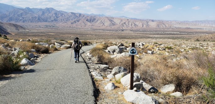
It was the end of a day and a half journey on the Pacific Crest Trail(PCT) and the wheels were already in motion for the next adventure. This would be the longest attempt on the PCT, one that would take 6 days, go from one mountain range to the desert floor and up another mountain range, cross the Palm Desert and pose the biggest challenge so far. This trek would go from Idyllwild, Ca to Big Bear, Ca. There was no time to waist, the planning had begun.
The first thing that needed to happen was gear. Although the current gear was good, it was not ideal and thus the hunt began. As always with buying new stuff is money and I was on a budget. The backpack and sleeping system were the priority. After some research it seemed as if I would be getting a Z-Paks bag, that was until I found out they were custom made and it would not arrive in time. The alternative was probably better, going with an ÜLA Circuit. This was a 68 liter backpack that shaved off almost 3 pounds of my old bag, a welcome change. Next I replaced my Therm-A-Rest Z-Lite with a SeaToSummit Ultralight blow up pad. This added about 10 ounces of weight, but presented a much more comfortable sleeping surface. The mummy bag (sleeping bag) was gone, and a quilt used in its place. This was a 15° down quilt, which worried me in possible hot weather and how it would perform but only time would tell. And finally the cooking system went from JetBoil to MSR, lighter.
With all new gear it was time to pack it up. With just some food left to pack, a few clothing items and the necessary electronics the total pack weight with 3 liters of water was at 28 pounds, a great improvement from 35 pounds with no water. Excited did not even begin to describe the feeling, the pack was significantly lighter. Everything was set to go back on the trail.
The day had arrived. It was time to set off. I was excited and apprehensive. Ahead of me was the biggest descent and ascent of the entire trail, more than 25 miles through the desert with little water, areas of isolation where only a helicopter could get you out, and heat. The morning did not start well, we could not find one of my socks. Could this be an omen? Should I even go? But the sock was found and we were on our way driving the two hours to the trail head. It was on!
DAY 1 : Saturday May 26th, 2018 : Idyllwild, Ca : Devil Slide trailhead 0830 PST
Finally at the trailhead, hikers were greeted by a Ranger asking for permits. Opening my bag way before I thought I would, I dig deep into my bag and produce the permit. The Ranger reviews the permit, initials it, I stuff it back in my bag and I am on my way. Devil’s Slide Trail was my only way to get to the PCT, this would be a 2.5 mile 1,400 foot ascent to the PCT. Fortunately, it was still early, cool and I was fairly well rested. It did not take but a couple of hours for me to make my way up. However, about a half mile from Saddle Junction, where I would be back on the PCT, I met an Army Veteran. His name was Andrew and he is from Hemet, Ca. This young man had been out of the Army for a few years and was homeless. Talking to him, the subject of PTSD came up. He is afflicted and hikes to deal with his PTSD, as well as giving him a place and reason to camp in the mountains. His biggest complaint was the stigma that is often associated with having PTSD, even at the VA. After a good chat, he headed down the mountain and I up. I would think about his plight for a while and how others are affected by the stigma that is attached to PTSD. This was not a problem, this is what the Trek4PTSD is all about.
Finally I made it to Saddle Junction, mile 179.39 on the PCT and the journey continued.


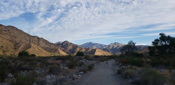
Along the way I had seen Tahquitz peak soaring into the skies above and a blanket of clouds cover Idyllwild and the valleys below. The journey was still fresh and exciting, what would this day show me? What would this journey bring? There was just one way to find out. Then, just as if I was in Frost’s poem, I had a decision to make; go right off the PCT and to San Jacinto Peak or go left and stay on the PCT. Most hikers take a right in order to take in the spectacular views provided by the peak. I, however, had already seen the peak and took the trail less taken. This path would take me on the western side of the range with spectacular views as I walked above or in the clouds. This journey was also more difficult since it was not well traveled and in many spots the trail was almost gone, but I trekked on taking in the beauty and wonder of the San Jacinto Wilderness.
By midafternoon, the altitude and hours of walking had begun to wear on me and my pace began to slow. This was expected and I embraced it, there was nothing I could do to change this. Along the way I ran into a Scout troop that I would leapfrog with over the couple of miles, they were headed to Round Valley Campground for the night. Then, a junction I recognized and here is where I would last see the Scouts as their trail continued up the mountain while mine went down.
A half mile from where the trail splits and almost seven miles into the journey, I would encounter my first water source. Upon arriving at North Fork San Jacinto River, I met the first PCT hikers of the trip. Getting ready to set back out was a Frenchman and Czech whose names were too difficult to remember and Cameron, a Royal Army Veteran from Scotland. We hit it off almost immediately and I hoped that this would not be the last time our paths would cross. As I filled up my water supply we got to know each other some more and I prepared for the next 20 miles, which would be deprived of water. As we continued our conversation, a young lady arrived. Caroline was her name, a 23 year old from Nashville, Tennessee who had started two hours before me at Devil’s Slide but had gone right to the peak. This meeting would prove to be the most significant and important one of the entire trip.
It was time to finish getting my water, drinking as much as I could and pack up. There was still a lot of traveling to do that day. Just before I set off a couple arrived. Abby and Kaj from Seattle, Washington had stopped to get some water themselves. It was going to be a long and hot 20 miles and water was going to be a hot commodity. There was little time to waist and I headed out. At the same time, Caroline headed out and this was the beginning of a partnership that would last 85 miles. We both had the same pace and we began to keep each other company. For the next 5 miles we experienced some beautiful views, including some that looked like they could come out of Harry Potter. 
As the afternoon began to fade away we drew closer to our campsite. By this point, Kaj and Abby had passed us by, but that did not deter us from pushing forward. Finally, we arrive at Fuller Ridge campsite at mile 190.53, roughly 14.5 miles into the day according to my watch. As we arrived at camp we were greeted by a warning; a bear was just spotted near camp. By now, everyone who was at the water source, minus Cameron, a father/daughter pair and an overnight hiker were at the campsite. The most welcome sight was a camp fire that was being built. We choose a spot to set up our tents, set up camp and break out our cooking gear. As we head to the table next to the fire we see Cameron head into camp. It was going to be a fun night. After cooking dinner, having some stimulating conversation and enjoying some s’mores, it was time to put our food out of the reach of the bear and try to go to sleep. The night would be a chilly and worrisome one, after all a brown bear had been spotted earlier in the night.
Day 2 : Sunday May 27th, 2018 : PCT Mile 190.53 Fuller Ridge campsite
The day began a bit chilly. I knew that today would be a long downhill hike to the desert floor. I poured the water into my cooking system in order to have my morning coffee. As I was preparing to get it off the stove and into my cup, it spilled. This was not what I wanted to do, I needed all the water I had to make it the next 15 miles. Then I had a realization, I may not have enough fuel to make it all the way. This was the first time using this new burner and it used a lot more fuel to boil water. I voiced my concern to Matt from Temecula, California. He was headed back home today after a 10 mile hike back up the mountain. Matt offered to trade me fuel canisters, his held more fuel than mine. Apprehensive, I asked if he was sure to which he replied that I needed it more than he did. I was extremely grateful for his generosity and elated that I would have enough fuel to last me the rest of my trip. After an attempt to eat my breakfast, PopTarts, it was time to head out.
Caroline and I set off on an inspiring morning as we made our way through the pines with views of the desert floor below. As we continued our way down the mountain the forest began to thin, the trees became sparse and the shade began to dwindle. Suddenly the sun was beating down on us and the heat started to overtake us, it would prove to be a painful 6484 foot descent. As the day progressed there were several concerns we had to deal with, the heat and pain of the descent being the obvious ones. But the heat brings a second issue, water. The conditions made us thirsty, very thirsty. Water was still miles away and rationing was the order of the day, every sip was calculated. With every mile I was doing the math as to how much water I could drink per mile. My biggest fear was a possibility today, I may run out of water in the desert, I needed to be smart. Along with the heat, pain and lack of water, there was an even more menacing threat to our wellbeing, bees. Reports had stated that there was a beehive next to the trail and around mile 198 bees became more prevalent. For me all these threats and fears went away for a minute when we reached mile 200. This was a milestone, it had only taken 2 years to do the next 100 miles of the PCT. But all things must come to an end and we soldiered on. A mile later we encountered the hive in a shady area in the rocks. We did our best to move quickly past the hive and came out the other end unscathed.
The descent had proven difficult so far and with just a few miles left I was left with just one liter of water. The rationing became more stringent and I held each sip in my mouth for a while in order to moisten my mouth and lips. Suddenly I slip on the rocks and twist my left ankle. This was not the first time I would twist my ankles nor the last, this was a common occurrence for me. What made this twist more significant is that it tweaked my knee, a problem that would plague the rest of the trip.
As we checked our mileage we knew that we were closer and closer to water and I began to drink more and more of what I had. This was a gamble since if the faucet was off or dry I would have to endure another four miles to where I hoped there would be water. Then, as we turn a corner we could see other hikers around the faucet filling up. This was a welcome sight and a reassuring one at that.
Here at mile 205.74, 15.21 miles after we left camp, we reunited with everyone and some new faces. This is where I would meet “Avatar” from Portland, Oregon. We all sat around for a while, resting our feet and joints from the descent as we filled up on water. This was the only reliable water source for the next 13 miles. And once again, it was time to head out. Now came the next decision, where to camp for the night. The next 4 miles would be over paved road and loose sand. Both provide problems of their own and the I-10 Oasis as it is known seemed as if would never come. The illusive underpass finally came into view and we arrived to the fanfare of other hikers who were under the interstate. Here we were greeted with some wonderful trail magic. The first thing I had was a Natural Light beer. Typically this would not be, by any means, my beer of choice. But after a long, hot and difficult day, it was the best beer in the world.


Many of us made the decision to camp under the interstate that night. Doing so had its pros and its cons. While it provided shelter from the wind it was noisy with the interstate above and railroad tracks a hundred feet away. This was a certain campsite and we welcomed it. We settled in for the night, ate our supper, drank a soda or two and tried to go to bed.
This night would prove to be a challenging one with temperatures in the 80’s at 8pm, a noisy interstate and the concern of being under the interstate where anyone could come by at any time. Another concern I faced was my 15° quilt, would I bake? I opened it up like a blanket and only covered a small portion of my body. To my surprise, it was the sleeping pad that would reflect my body heat back up to me while my quilt was surprisingly cool and comforting. On edge through the night I kept checking my surroundings and later in the night I saw another hiker make his way in. Later on I would find out it was Cameron making his way back to the trail after hitching a ride to In-N-Out. I would get little sleep that night.
Day 3 : Monday May 29th, 2018; Memorial Day; PCT Mile 209.48 Interstate 10
The day began watching a hiker, Cameron, leave camp. Across the street from where we were a car pulled over. This was odd because there was nothing there and if someone was coming to where we were, they could just drive up. Then a lady emerged with a few bags in her hands and made here way towards us. She passed our tents and I watched her make it to where the ice chests and hiker boxes were. She was one of the people who hiker love most, she was one of the Trail Angels that maintained the I-10 Oasis. I watched as she dumped out the water from the coolers and replaced it with new ice. Then she added more sodas to it. I walked up to her and thanked her, this is also where I learned that it was a group of people that maintained the cache. After her departure I noticed that there was something more in the hikers box, a plastic container where hikers can place unwanted items and other hikers can take them if they needed them. Upon further inspection, she had brought bananas, Kind bars and individual gas station apple pies. This was another welcome sight and would be our breakfast for the morning.
After packing up our camp and eating our trail magic breakfast, we headed out. Almost immediately the sun began to beat down on us and the cool morning air turned hot and dry. Today the plan was for a short day, ten miles, to Whitewater Preserve. We departed with just two and a half liters of water, after all it would be a short day. This was the day I was looking forward to, an afternoon of basking in the cold water of the Preserves wading pools, an easy day. The notion of an easy day was soon shattered as the poor night sleep, sweltering heat and unforgiving sun punished every step we took. Just a mile or two from camp we encountered a couple of chairs and took a break, today was not going to be easy, not at all.
As we made our way through the desert floor we encountered yet another milestone, mile 212.11. This is the end of PCT California Section B and the beginning of Section C, I
 had finished another section. But this short 3 miles were not easy or short, we trekked on through the heat.
A little over a mile into Section C we found a breezy rise on the trail to sit for a while, enjoy the breeze and have a quick bite. Just a few hundred yards after we started back up we saw a sign that said “water and shade” with an arrow pointing right. We could see the area just a hundred yards away but opted to continue. Later in the day we would find out that the water was frozen water bottles and they had Klondike bars, which would have provided much needed calories and refreshment. As the day grew longer, the trail got steeper. By this point we realized that we had been going up this whole time. This accounted for the difficulty we were facing. Suddenly we were faced with a series of steep switchbacks leading up the side of the mountain, the only way out of this valley. We mustered up every little bit of energy we had and climbed. The breaks were multiple and we made it out. At this point, we saw our mistake. The amount of water we thought would be sufficient, was not really. Worst of all, we now had to go down. Downhills are painful enough, but my knee was not really looking forward to them and neither was I. By now we had lost service and we began our descent. There were now three ways out, finish what I started, head back up and down the five miles I had just walked through or make it to the Preserve and get a ride out. I would at least make it to the Preserve.
The day did not become any easier as the trail made its way up the side of another mountain. We took a break in the little shade we could find and then a few minutes later yet another with no protection from the sun, Caroline needed some food. As she was wrapping up her snack another hiker arrived, “Giggles” from Arizona. He had started six miles further back from us and yet had caught up. He had the fortune of stopping at the “water and shade” sign and had a bottle where half the ice had melted. After offering us a drink he gave it to us. He figured we needed it more than he did. It was a welcomed sip of ice cold water. I poured some of my water into the bottle to give us a bit more ice water, soon there after the ice was gone and we consumed the little, precious water before it would warm back up.
As we made our way down the last mile, we could see where the trail splits and heads to the Preserve. The sight of this junction gave us a boost and we sped up if just a bit. We could see the vegetation where the river fed the desert floor to give life. The sound of the rushing “river” gave us a sense of hope that today was almost over. After a quarter mile we could see the rushing water and there in the middle was a young lady sitting in the middle of the water wearing a bikini while a gentleman took her picture. Although close enough to touch the river and drink from it, we made our way over the few small bridges that led to the preserve. It was Memorial Day and a few hundred yards away we could see the families making their way to another portion of the water to enjoy the day.
Over the last ten miles, there were two things that drove me to continue forward. The first was the mutual support between Caroline and me. The second one was the reason for my journey. It was not just that today was a day to remember my fallen Brothers and Sister who have made the ultimate sacrifice in defense of our country. I remembered my friend, Sergeant Mark Johnson IV USMC, who died on 12 May 2015 while crewing and UH-1Y helicopter in Nepal in support of the relief efforts after a massive earthquake ravaged that country. But I also remembered the 22 Veterans who take their lives every day as they lose the battle to their demons and PTSD. Today was about all of them and I would not let them down. I made it to Whitewater Preserve hot, tired, parched and in pain, but I made it.
Upon our arrival, around 3pm, we witnessed kids playing in the wading pool fed by the cold waters of the river. There, standing at the “entrance” to the pool and trail, were two rangers. Inquiring as to where we could go and camp they pointed us south towards a wide-open space. The Preserve provided fresh water, flat grassy land to pitch our tent, flushing bathrooms, tables to sit at and the wading pools to relax in. The Rangers also informed us that we, PCT hikers, could use the phone inside and the outlets outside. The Preserve would close at 5pm, but we were welcome to stay and enjoy.
As we made our way to the area the Ranger had pointed to, we ran into some familiar faces. There, laying in the shade sleeping, was Abby, while Kaj was sitting on a bench reading his phone. Giggles was also there, as was Jeremy from Nevada who had passed us shortly after Giggles had. It was not long before we dropped our packs and changed into more comfortable attire that could let us enjoy the surroundings. I had gone in the bathroom and taken every article of clothing off my body. I put on my clean undershirt and sleeping/running shorts. I washed my socks, skivvies and shirt in the sink and then draped them over a tree to dry. After eating a snack, we made our way to the wading pool. They were freezing cold and their one-foot depth made them very difficult to get into quickly. Our bodies were still running hot and the drastic temperature change made it even harder to acclimatize. But, our desire to relax, cool off and give our bodies the regenerating time they needed, we made due. It must have only been ten minutes, but it felt like we were there for a good half hour. None the less, it was a much-needed break.
Making our way back to the picnic tables, we could see that people who came out for the day were beginning to pack up and someone suggested asking if there was anything, food or drink, that they didn’t want to take back that we would be glad to take it from them. They were referring to a Hispanic group just a few feet away from us. I decided to put my people skills, and native tongue, to work. I asked if they knew what the PCT was, they did not. I proceeded to tell them about it and how we were all hiking it in one way or another. Then I proceeded to tell them that while we were not begging, we would be grateful if there was something they could leave behind. A short while later, a lady walks over with a bread bag with a few sandwiches in it and a bag of chips. We graciously accept and find four sandwiches in the bag, there were five of us standing around. Kaj said he did not want one and the math became simple. The sandwiches were not anything special, regular picnic fare. They were simply two pieces of white bread with mayonnaise on each slice, followed by two thin slices of turkey deli meat and what we think was either American cheese or Cheese Wiz in the middle. But to us, they were the best sandwiches on the planet. As simple and plain as they were, to us they were a gift we could not expect. Shortly thereafter, a gentleman comes up to us with a whole round watermelon and a knife. After cutting it up, cleaning and returning the knife, we all take a slice, hydration and calories all in one. A while later we receive three unopened bags of chips and two which were open, we were eating great tonight. It was a reprieve from trail food and we finished every single bite.


As the afternoon continued, more hikers began to arrive. First Cameron made it in, he had stopped at the “water and shade” for a few hours to get away from the heat. Then a lady, who’s name escapes me arrived, she was from Scotland as well. Then an odd character wondered in. She was a through hiker from Vancouver, who had flip flopped and was trying to maker her way to Palm Springs for whatever reason. After repeated attempts to hitchhike to Palm Springs she was able to call a cab, it would be there later in the afternoon. Then a van pulled up around 4:50pm and introduced our next interesting character “Carburetor”. The girl from Vancouver managed to get a ride in the same van that Carburetor got out of, that would be the last we would see of her. Carburetor on the other hand was an older gentleman, we figured in his 60’s, stocky and a bit short with a long white/yellowish beard. He had his pack and two big plastic bags, he had just made it in from town.
We all sat around the table eating chips, telling stories and having fun. I would go on to eat a “1 Serving” meal I had to give me even more calories for the next day. Then Carburetor made his way to us with cookies and talked to us for a few minutes. Like I said, he was a character. His stories lacked structure and there was no transition from one thought to the next. This would later provide us with entertainment thanks to Giggles uncontrollable giggles as he retold the old gentleman’s stories. Carburetor seemed like a likable individual who you could tolerate in short doses. But he had no problem carrying on a conversation, if even with himself.
Night began to fall and it was time for us to make our way into our tents. The entire afternoon had dragged on, but in a good way, and now it was time to sleep. There was one thought that I could not get out of my head as I laid down. How many times would I have to get up in the night to go to the bathroom. I had spent the entire afternoon drinking water to replenish what I had lost over the last two days. It was still a warm evening, and once again I had trouble going to sleep. I witnessed the full moon rise over the side over the side of the canyon and as predicted I rose multiple times to use the facilities. Fortunately, it was a cool night and I was able to get some much-needed rest.
Day 4 : Tuesday May 29th, 2018; Mile 218.55 Whitewater Preserve
As the sun began shine on the Preserve we all awoke to the sight of ants covering our tents. Nothing major, just enough black ants to make you take notice. The use of real facilities made the morning routine a lot better and I ate my last pack of PopTarts as I broke camp. By the time I was done packing, I had broken a slight sweat, today would be hot. As we made the final preparations to depart, most of the hikers that had spent the night there were on their way. We drank as much water as we could muster and filled our bottles just enough to get us through the next 2.5 miles. Just before we stepped off, Giggles and a German hiker made their way out of camp. Putting the packs on our backs and picking up my walking sticks we continued our journey.
The next 2.5 miles were uneventful. We could see the German a couple hundred yards ahead of us and it was getting warm as the sun started to hit us directly. Then we arrived at our last crossing at Whitewater Creek. The creek had enough flowing water that crossing it would be difficult. Finding a suitable place to cross, we carefully made our
 way over the rocks. We did not want wet shoes the rest of the day, so we tread lightly and came out dry. We stopped at the creek to fill up on the cold water that flowed down from the San Bernardino Mountains and cameled up for the next 6 miles. After soaking our buffs in the cold water and putting it around our heads, we were once again on our way.
The next six miles would present a challenge, although not as much as the ten miles of the previous day. On this day, the temperatures would climb above the century mark. Every step we took seemed to take more and more energy from our bodies. Our next source of water would be Mission Creek and we prayed for shade. As we made our descent into the valley floor we could see the faint outline of the creek. As we made our way to the creek crossing, we could see a nice tree that provided just enough shade. Our prayers were answered.
When we arrived at the creek crossing, around 11:30am, our packs were quickly off our backs and we drank all the water we had and filtered the creek water to fill our bottles up once again. It did not take long for our shoes to leave our feet and we soaked them in the creeks cool flowing water. With plenty of water to drink and a nice snack in our bellies, we settled in for an extended break. I used my pack as a pillow and some rocks to raise my feet. I placed the moist buff over my eyes to keep the few rays of light making their way through the branches out of my eyes. It was not long before we both gave into the exhaustion and were napping. A couple of hours later, slightly rested and fairly well hydrated, we were once again off on the trail. The rest of the day we would cross Mission Creek many times and water would not be a problem; the heat was a different story.
The heat would be our biggest nemesis on this day and breaks were frequent. At one point, as we rested, the Scottish lady passed us by. She would be the only hiker we would see this day. We began to contemplate where we would stop for the night. There were two campsites about a mile apart next to the creek, we would stop at the further one. As we made our way over the creek to the near campsite, we would run into the Scottish lady once again. This is where we would hear about Carburetor one last time. It appears that his pace was slow and was still carrying one of the plastic bags. He had left later in the day and with the heat and water situation it would be a source of concern for us through the rest of our journey together. It would also be the last time we would see her as we said our goodbye’s.
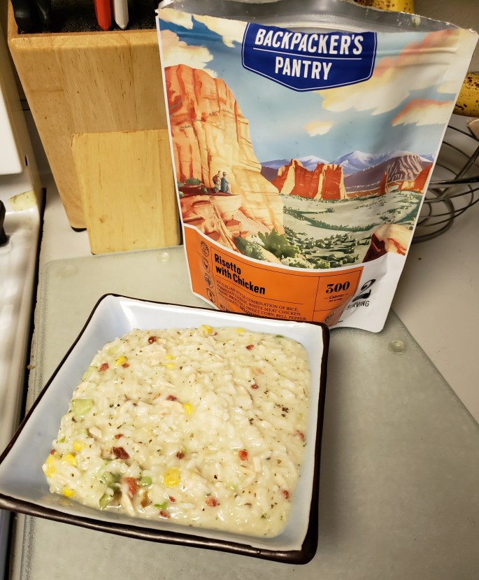
As we arrived at our campsite for the night, the first order of business was dinner. I opted for a Chicken and Dumplings dinner, while Caroline had a Burrito Bowl. It is amazing the freeze-dried meals you can purchase these days. As for the past two nights, hydration was the primary concern and we did our best to drink as much water as we could. To our good fortune, we had climbed above 4,000 feet and dusk was cooler. The sun made its way behind the mountain earlier than before and the mercury began to drop. This would be our most comfortable night of the trip. Without my rainfly on my tent, I could gaze up at the stars and watch the moon rise, a peaceful sight. I would get the most restful sleep on this night.
Day 5 : May 30th, 2016; Mile 232.13 Mission Creek
Dawn turned into morning I awoke rested to find a beautiful Southern California morning. It was just cool enough to not be cold and the mountains to our East shielded us from the morning sun. I stepped out of my tent and faced towards the direction of the rising light. Then, as if I was in a movie, I stretch my arms towards the skies and take a deep breath of the fresh morning air. We could see the mountain ridge in the distance with pines along the ridgeline, it was hope that the sparse desert floor would give way to alpine forests and shade from the unforgiving sun. The morning routine repeated itself and we headed out hoping that relief from the rays of the sun would arrive sooner rather than later.
By this point, our bodies had begun to get use to the weight on our shoulders and the tens of thousands of steps we would have to take each day. The climbs became much easier and we were no longer gasping for air, breathing became easier. Today would bring two challenges, neither we had not endured so far, steep ascents and lack of water. The first half of the day would allow for plenty of water, but the second half would not.
We made our way through along the creek and here we would see our first “exotic” wild
 animal, a beautiful California King snake. It made its way off the trail and into the bush, we kept on the path. Around 11am we would arrive at the last crossing of Mission Creek. Already within the burnt pines of the forest we would find a semi shady spot to take a break. As before, we rested our feet in the river and drank more water. This would not be the last water of the day, but we drank what we could. Our time was short here due to concern that Caroline might have brushed up against some Puddle-Dog Bush, a California mountain shrub known to give severe and painful skin irritation. Knowing that a mile later there would be a spring, we opted to take just enough water to get us the next mile.
Finally, out of the desert and under the protection of the forest canopy we arrived at the trailhead to the spring. This is where we would drop our packs and slack pack it the quarter mile to the spring. The walk was brisk and quick without the weight of the packs on our backs. The cold water was a welcoming change to the warmer creek water. Once again, we faced a 15 mile stretch without water. We took five liters each to get us through this section, the only relief is that the temperatures will not be as hot nor will the sun beat down on us. A couple of miles later we would reach an overlook where we could gaze down on the Palm Desert and Palm Springs. This would also be the first time since leaving I-10 that we would have direct contact with the outside world via cellular phone. We took the opportunity to call our families and friends and let the world know that we are doing well.
Temperatures began to drop quickly as the afternoon sun found its way down towards the horizon and we climbed in elevation. We arrived at Coon Creek Cabin, a dilapidated cabin a couple of hundred yards from the edge of the mountain. The cabin is “maintained” for use, but in need of repair. We had no reservation for the area, however with the lack of occupancy for the night we made it our home for the night. Taking a seat at one of the picnic tables, we prepared for dinner and enjoyed the warmth of our supper as the temperature continued to drop. There were two small structures a few feet from the cabin, this is where we would set up our tents for the night.
On this night the thermometer would plummet to the high 30’s, a sharp contrast to the triple digit temperatures of the previous few days. Cozy in my tent, rest eluded me. Every noise put me on edge thinking that either animals or non-hikers would come along. At one point I heard what sounded like someone chewing on ice, very loudly. But I tried to rest as much as I could. After all, we still had another day and some change of hiking to do. I laid my head down and did my best to sleep.
Day 6 : May 31st, 2018; PCT Mile 246.4 Coon Creek Cabin
I awoke to Caroline calling out my name about 5:30 am. We originally intended to rise at 5 am but sleeping in was not a bad idea. As I emerged from my tent I made the 200-yard walk to the edge of the mountain to catch a glimpse of the sunrise. To our misfortune, we were facing the south towards Palm Springs and there was a peak to our east which blocked view of the rising sun. However, watching the early morning light flood the desert floor in its warm glow was just as good. Then it was time to eat breakfast, pack our gear and set foot on the trail once again.
There were about 20 miles to go before Hwy 18, our stopping point on this leg. The plan was a 16 or so mile day, find a campsite for our last night and finish the last 4 miles the next morning. This plan was not perfect but we could do it. I had enough food for one more night and Caroline was almost out but we could share and manage. Less than a mile into the day we saw a deer on the trail hopping away. It was a good start.
The cold mountain air, early morning and 5 days of ups and downs meant that our bodies had started to get use to the routine. This meant that even at 7,000 feet in altitude breathing was no longer labored. As we climbed in altitude, it was not necessary to take breaks as often. Our pace seemed to be just as fast going up, down or on flat ground. The trek felt good regardless of what situation we were in. The only problem I faced was my right knee, which did not like the downhill’s most of all.
Four miles in, we arrived at the “Private Zoo”. This was one of the spots that we were looking forward to and also made us mad and sad. Here would be the only time where we would actually see a bear. Two grizzlies to be precise. The zoo houses animals that are trained for TV and film, their enclosures are relatively small and it was sad to watch them there. The facility housed lions and tigers as well, however on this day they were not there. There is a for sale sign on the fence as well as a sign that says that they are moving to a new facility with larger habitats. It was sad to watch these majestic creatures in such small enclosures. The only upside to the encounter is that I was able to see a grizzly on the trail without being in danger. This took us to mile 250 of the PCT, the second milestone on this trip.
Once again, we were on the move and moving at a pretty good pace. Just three miles after the zoo we made it to the Big Bear Hostel trail magic spot. Here, in the middle of no where is what looks like a small dumpster and a couch. The dumpster is anything but. The hostel had put it out to allow hikers to get rid of some trash, they placed 12 packs of
 sodas, emergency food and hostel information. We were disappointed to find that there was no soda left, but the sentiment was well received. This was a nice little spot and we dropped our packs and sat on the couch. It was really comfortable and a great spot to take a break, eat a snack and drink some water. Time check showed that we had gone 7 miles in three hours, an excellent pace for two slow pokes like us. At this point, I ask Caroline if she wanted to push and finish today. At this pace we would be done by 4pm. The decision was made, we would do all we could to finish today. Turning on our cell phones we were lucky to have service. She made arrangements to stay in the hostel and I made my arrangements to be picked up that afternoon. Now our focus was on the margaritas we would have once we arrived at Big Bear City. The other decision we had to make was whether we tried to hitch into town or call an Uber. I suggested we wait to see if we could hitch before spending money on a ride, she concurred.
The rest of the day seemed pretty uneventful. Then the trail threw us a curve ball, we were back in the desert it seemed. The alpine forest had once again turned into an arid sparse landscape that provided no relief from the afternoon sun. To our good fortune,
 the temperature was barely in the 70’s and there was a nice breeze. Having learned our lessons from the desert floor, we did our best to stay cool by keeping our sleeves rolled down and using as much as we could to protect any exposed skin from the rays of the sun.
Pushing on we would stop occasionally to rest or have a snack. These were usually short, we were on a mission. I am certain that from our vantage point at 7,000 feet we could see parts of the Mojave and Death Valley. It was amazing that we had experienced so many different environments in such a short period of time. The views were spectacular, this is one of the reasons we hike.
At around mile 264.8 I pulled out my cell phone and opened up the Halfmile App. I watched as the mileage crept up. Finally, the app said 265, I was overjoyed. This is when I asked Caroline to take my picture. I posed for the picture by grabbing my poles and thrusting them up in the air. After the picture was snapped and I began to explain the significance, I noticed the rocks to my right. There, “spelled” out in rocks was “265”. This was a major milestone for me, I had completed 10% of the Pacific Crest Trail. While 10% might not seem like a lot, it was a major accomplishment. We both snapped pictures of


each other next to the 265. At this point I called my wife. After some banter, I explained that none of what we were talking about was the reason for the call. Then I told her, I made it to mile 265. No explanation was necessary for the number, she responded with a very loud, “SHUT UP!”. A tear came to my eye and I did everything in my power to keep my composure. This was a moment two year in the making, a major point in my journey and the Trek4PTSD. This was also the moment that I looked at my feet, on the opposite side of the trail there was, in rocks, “10%”. Awesome does not begin to explain the feelings I had. Validation was what I felt.
With just a mile to go we kicked it into high gear. As we rounded the last few corners we could see the highway. Now we had to figure out which side of the road we needed to be in. Then as we make our last hundred yards to the road, a truck pulls over. The driver maneuvers several times and comes to a stop on the other side of the road. Our feet touch the pavement and we were done, now to get a ride into town. The driver of the truck opens the door and gives us a warm greeting. A bit confused as to the motive of the driver to pull over, we ask for a ride. As he pulls down the tailgate a familiar face comes around the truck. Jeremy, who we had not seen since Whitewater three days earlier, had hitched a ride back to the trail and was setting off once again. The timing could not have been more perfect. This meant we did not have to wait around, we had a ride. But the best part was that we were able to see one of our fellow hikers one last time before he set off once again. We threw our packs in the truck and the trail was now behind us. It was done, we had made it. Caroline would be spending two nights in Big Bear before heading back out and I would be going home. This part of my journey was complete.
Post Trail: Big Bear and Home
Our ride took us to Big Bear City where we would find a Mexican restaurant to have some drinks before going our separate ways. Caroline had promised me a margarita and I was not one to turn down a free drink. Upon our arrival at the restaurant the waitress asked us where we would like to seat. Being well aware of our odor, we told her “anywhere we won’t offend”. With a huge smile on her face, she replied that we would not and we could sit where ever we want. We took a solitary boot with some great views of the lake and the town. After ordering our libations we reminisced about our experience. Suddenly I notice a familiar face walking up the street. I rushed to the window and yelled “CAMERON”. He had become one of our best friends on the trail, a “proper” mate. He talked to us through the window and I headed out for an obligatory selfie with him. The waitress arrived with our beverages and that was Cameron’s cue to say, “I’m coming in”. We would all celebrate our minor accomplishment together. This was a joyous gathering and we ate chips, guacamole, rolled tacos and drank our margaritas. We recounted our journey and exchanged information. We knew that my wife was on the way and our time was short. Finally, my wife and son arrived. I was happy t o see them and as I told my trail family goodbye we all parted ways.
The ride home began with a trip to McDonalds, something that I had been craving the past few days. This craving probably had something to do with the fact that it was my son’s favorite place to eat and I missed him so much. The visit was as much for him as it was for me. I ordered a 10-piece nugget meal and 3 cheese burgers. It would take me most of the two-hour trip home to finish, my Mexican restaurant indulgence had left me fairly full.
The trip was mainly quiet, something unusual for my post trail pickup. Then it hit me. I was not ready for the post trail depression to hit me so quickly and with such power. I became emotional, I already missed the trail and my friends. Knowing that it may be another year, or more, before I am back on the PCT, that I may never see these friends again, that there is always a possibility that I will not make it back was difficult to handle. I was not myself.
The next few nights I would not sleep very well, something I did not expect. For the four days following my return from the trail I would be in a slump. A week later and I am still extremely tired. Things are not back to normal and the depression has yet to subside. Everyday I think of those I met on the trail and how they are doing. How I wish I was out there with them. The knowledge that they are out there trying to complete their goals makes me happy. I met my goal for this trip, but how I wish I could have continued.
The trail changes you, it becomes a part of you and who you are. While you may leave the trail and drop your pack, the trail will never leave you. When John Muir said “The mountains are calling and I must go”, he never told us how loud and constant they would call. For the time being, they will have to wait. It is now time to plan the next adventure, to gather the gear needed and look forward to the next time my boots step on the PCT once again. Until then #TrekOn!

 Sunday morning came with a beautiful sunrise. My legs, which I was sure would be in knots by morning, were fresh and ready. I boiled some water and dug in my food bag for what would be breakfast. But once again, no appetite. I could not drink my coffee or eat my breakfast. With that realization, I broke camp and began heading down the mountain. I knew that in less than a mile I would have to begin another grueling ascent, something I was not looking forward to.